Friday Tours
The Urban Clinic’s Friday Tour Series is meant to expose students, professionals, and residents to different neighborhoods and areas in Jerusalem and their specific planning and urban social challenges. In a city as socially, religiously, nationally, and ethnically segregated as Jerusalem, many residents rarely leave their spatial comfort zone. These tours provide an opportunity for people to interact with the “other”, through personal conversations and by interacting in their neighbor’s space. The tours, led by local community planners, social workers, members of civic organizations, and local residents also provide a platform for an exchange of knowledge between students, professionals, and community leaders. Each tour finishes with a picnic and open discussion in which participants and tour organizers trade ideas, impressions, and insights. The Friday Tour Series has been active since 2014, and engaged close to 500 students, professionals, researchers, and community members in its mission.
2017-2018 Tour Season
In the past, every tour has been lead by the local community planner in association with the community association. This year, in addition to working with community associations, we are featuring a different Jerusalem NGO or civil organization that has a spatial or social aspect to their work.
March 3rd 2019 - Neve Sharet
What happens when an entire neighborhood is entering a process of urban renewal by "Raze and Rebuild" ?
We visited Neve Sharet, an aging neighborhood in north Tel Aviv, where recently populated building stand next to old building waiting for renovation. The title the neighbourhood's tour was, adequatly: "urban renewal lab' , as we were taken around by two voices: on the one hand, an urban planner from the municipal planning department: Tamir Kehila; and on the other hand, with him, the local resident's council chairperson: Ami Sofer.


May 3rd 2019 - Projects in the Shapira neighborhood of Tel Aviv
Beyond buying a home, or renting from a private landlord -- what are other ways of living in the city? The Urban Clinic's Friday Tour on May 3rd investigated through visiting three projects in the Shapira neighborhood of Tel Aviv. First, the VENN project in Tel Aviv (see link and article) rent small furnished and managed apartments, with rental including 'membership' in services around the neighborhood: a shared work space, a music production studio, a tool-library, and more. The project seeks to make a profit for private sector investors as the community services increase the value of real estate in the neighbhorhood. Second, Ganei Shapira is the city's first attempt at developing long-term rental properties, at a monthly rent pegged to the average income -- about 30% - 40% less than the market rate. The first wave of renters, eligible to stay for up to five years, is now moving out and the city is investing in maintenance and repairs prior to the new tenants. Third, the Communit project turns a building slated for demolition into a temporary co-housing situation, with small flats and shared spaces whose vibe, said one student, is "less high-tech than VENN, more like, um, fresh mint".
For more information:
https://bit.ly/2HgUHcq
VENN: https://venn.city/home-heb/
Globes article:
https://bit.ly/2HgVpX8
Communit website:
https://www.communit.co/


November 2017 - Givat Shaul with “Outside the Box Encounters”
Givat Shaul is an Orthodox neighborhood located near the entrance the city. This tour focused on ways that planners can better understand and anticipate the planning needs of a Haredi population. “Outside the Box Encounters” is an organization that facilitates encounters between secular and orthodox society. Founder Natanel Zelikovitz led our tour, exposing us to the culturally specific needs of Orthodox neighborhoods in the context of urban renewal, such as sukkah balconies, shabbat elevators, and use of public space.


December 2017 - Kidron Valley with “Community”
The Kidron Valley is an area to the south and east of the Old City that is comprised of a number of Palestinian neighborhoods. Representatives from Community, an Israeli non-profit that works to create “green communities” led us through three neighborhoods in this area; Tzur Bahar, Abu Tor, and Ras Al-Amud. In the midst of the severe lack of services and planning challenges in East Jerusalem, we saw many positive examples of community led planning, public participation, and creative uses of space and resources.

Making due with what little space they have, the girls at this school play in the parking lot underneath one of the buildings. Credit: Sheli Zaidman

Tour participants toured a girls’ school in Abu Tor with the school’s director. Due to the lack of public space, this school is located in an apartment building rented by the Jerusalem Municipality. Credit: Sheli Zaidman

East Jerusalem is constantly expanding, mostly up, as the population increases. Its dense neighborhoods and narrow streets stretch across hillsides. Despite its proximity East Jerusalem is culturally, socially, and politically segregated from the rest of the city. credit : Sheli Zaidman
February 2018 - Har Homa with "Tzahor"
Har Homa is a Jerusalem neighborhood south east of the city that is actually closer in proximity to Bethlehem in the West Bank than it is to downtown Jerusalem. This tour was led by representatives from the local community association, along with Yossi Havilio of the NGO Tzahor, which provides free legal advice and assistance. Tzahor helped Har Homa residents oppose the installation of a waste dump facility on the edge of their neighborhood. Besides this and other environmental concerns, we focused on the geopolitical context the neighborhood exists in, and other challenges in creating a thriving neighborhood so far from the city itself.
Despite its relative high density, the streets of Har Homa are nearly always empty. Its lack of employment opportunities (one or two elementary schools, a supermarket, and a few small businesses) most residents have to commute to Jerusalem or beyond for work every day. Since there aren’t any middle or high schools, even older children have to commute to area schools, creating frantic traffic jams at the neighborhoods single exit, and leaving a ghost town during the day.
Beyond its domestic challenges, the neighborhood suffers from isolation and disconnection from its neighbors. As mentioned before, neighboring hillsides are populated by Palestinian neighborhoods in Jerusalem on one side, and Palestinian neighborhoods of Bethlehem on the other. Hundreds of meters apart and divided by valleys and highways, the neighbors never cross paths. A few years back the neighborhood council, in partnership with the Jerusalem municipality attempted to build a shared soccer field for use by both residents of Har Homa and neighboring Um Tuba, as a way to foster interaction and physically connect the two Jerusalem neighborhoods. Har Homa vehemently protested the project, and it was cancelled.
Built as a blatant Israeli geopolitical symbol in the West Bank shortly before the the second intifada, today Har Homa is an oft forgotten bedroom community disconnected from the urban fabric of Jerusalem.

 Unfortunately, on the day of our tour the weather was extremely foggy and offered limited visibility.

Har Homa is located over the "green line" and is not physically connected to Jerusalem.
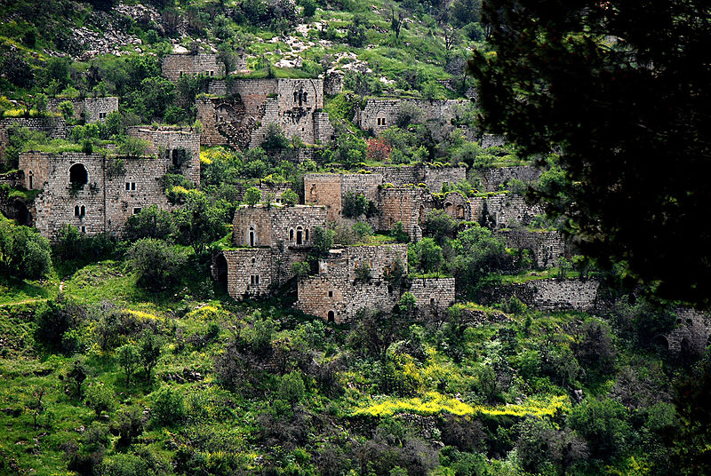
March 2018 - Lifta with "Save Lifta"
Lifta was a Palestinian village located on what is today a small valley near the entrance of Jerusalem. Save Lifta is an organization at the center of a struggle between people who want to preserve the historic village, and a plan for the creation of a new luxury neighborhood amongst the existing village homes.
Our tour in March was led by representatives of Save Lifta, including former residents of the village. Tour participants heard personal stories about growing up in the village, expulsion, and details of the current struggle to preserve this cultural heritage site.
 Depopulated homes on a hillside in Lifta. Credit: Yehudit Alyaoff

Lifta is located at the western entrance to Jerusalem
An essay by Clinic researcher Joanna Kramer on her experience at the Lifta tour:
Saving Lifta: A Place and Memory
Friday's tour of Lifta took participants through the remaining stone structures that still dot the hilly landscape, yet although we entered the physical space of homes and a mosque, the morning was more a journey through memory. Guide Yakub Udah was born in Lifta, fleeing with his family to the area around Abu Ghosh in 1948. For him, this was not simply an anthropological exploration of the village’s history; here was his mother’s home, here the gardens his family tended, there the house of a close family friend. For Yakub, the village was still very much alive, despite the growing weeds and municipal plans to develop the area.
 Guide Yakub Udah. Credit Joanna Kramer
A theme of the morning developed around the idea of mas’ah, an Arabic word described to us as the concept of collective ownership. As we passed a spring filled with laughing Israeli teens enjoying a Friday morning dip into its waters, Yakub shared that the village residents--known as Liftawis--would once gather around this same body of water to discuss matters of communal importance. This “town square” approach trickled into property structures; a tour participant, a student conducting his final project on Lifta for his architecture degree at Bezalel Academy, added that ownership of village land fell into both personal and collective structures. Today, associations of former Lifta residents all over the world, from Jerusalem to the United States, preserve the strong communal ties of the displaced residents.

A spring in Lifta. Credit Joanna Kramer
As we crossed in and out of more homes--monuments preserving a history that many, from government officials to real estate developers, would rather ignore--I reflected on the difficulty of exactly that task: preservation of a memory. It is a paradoxical feat, one that attempts to capture the multiplicity of a vibrant village into a static scene of time-worn stones. And of course, it is a painful one, a task with which Liftawis and their supporters would have preferred to never have been confronted. Yet, with Save Lifta’s campaign underway, and a stated goal of the movement to create “an open-air museum of the built and natural Arab heritage” where the village once stood, the question is at hand.
There were many points over the course of the tour during which participants were presented with an overly simplistic narrative of the village’s history. It was a paradise-to-hopelessness sequence, with 1948 serving as the moment of rupture. While this arc clearly holds emotional resonance with the experience of a Liftwai, as well as generates a metaphorical spring of sorts around which ex-villagers can still continue to gather and assert their collective identity, its generality robs the village of the fullness of its history. To claim that pre-1948, the village was all good, and only good, undoubtedly leaves out the neighbor disputes and political governance drama and interpersonal scandals that are the stuff of communal life, and are as equally integral to understanding the village’s history and development.
 Orginial homes peak out of a green hillside. Credit Joanna Kramer
Save Lifta is presented with the powerful and delicate task of imagining how to preserve memories without calcifying them. It is a process of learning that will require extensive conversation between former residents and architects, as they create plans for a site that honors Lifta’s history by presenting the full range of memories witnessed by the stones first laid thousands of years ago, and the lessons that emanate from the fact that they still stand today in 2018.
April 2018 - Ein Rafa with the local Village Association
Ein Rafa is an Arab village about 10 kilometers outside Jerusalem, across Highway 1 from Abu Ghosh. This tour was lead by the head of the Village Association Ala Barhoum, educator and Ph.D student Rayid Barhoum, urban planner Oren Melammed, and joined by a representative of the JNF. The tour focused on village history, and how a new detailed plan for the region will affect the tiny village. The new plan is part of Government Resolution 922, which allocated billions of shekels for the planning and development of Arab towns throughout Israel (excluding East Jerusalem).
Ein Rafa was founded in the 1920s by three brothers who lived in the nearby Arab village of Suba (where Kibbutz Tzuba is today). When land became scarce in their own village, the brothers decided to descend to the valley below to establish their own fields and homes. During the 1948 war the villagers briefly fled their homes, and in 1949 were recognized as a village and given Israeli citizenship.
Today the village is part of the Matei Yehuda Regional Council, one of 58 towns and villages with a total population of around 50,000 residents. Ein Rafa is one of two Arab villages represented in the Coucil, the other being neighboring Ein Nakuba. Ein Rafa has a population of 1,200 people, most of whom are part of the Barhoum clan, and Ein Nakuba has a population of 3,200. Ein Rafa has only a small primary school, so older students go to middle and high school in Ein Nakuba.
Despite their close proximity, the two villages consider themselves rivals and culturally unique. Residents of Ein Rafa consider themselves to be liberal, educated moderates, closer in character to secular Jews than religious Muslims. A new detailed plan attempts to connect the two villages and create housing projects that will serve both areas. The 600 units will be available for purchase for both villages, as well as outsiders. The plan also improves infrastructure and emphasizes tourism to a nearby spring and bike trail.
Ein Rafa residents are happy about the prospect of increased tourism, but unhappy about being lumped in with Ein Nakuba. They hope the new units might attract similar-minded, secular Jewish families rather than conservative Muslim families from East Jerusalem. They are also unhappy that they aren't being granted their own secondary schools, though the village's small size isn't enough to establish a school. Village Association Head Ala Barhoum's daughter attends middle school at Hand in Hand, a bilingual secular school in Jerusalem rather than the regional school in Ein Nakuba.
The tour brought up questions such as: how much should regional plans acquiesce to local residents and sacrifice practicality in serving the largest number of people? How will Ein Rafa's unique cultural and pastoral character change with the addition of housing units and increased tourism? Will the two villages ever accept their proximity as justification for cooperation?
 Looking out over Ein Rafa and Ein Nakuba. Credit Miriam Fisher
 Planner Oren Melammed and Village Association Head Ala Barhoum discuss the new detailed plan. Credit Miriam Fisher
 At the end of our tour we walked down the JNF bike trail that connects the village to a nearby spring, Ein Limor. Credit Miriam Fisher
 Our closing discussion/picnic was held at nearby spring Ein Limor. Credit Miriam Fisher
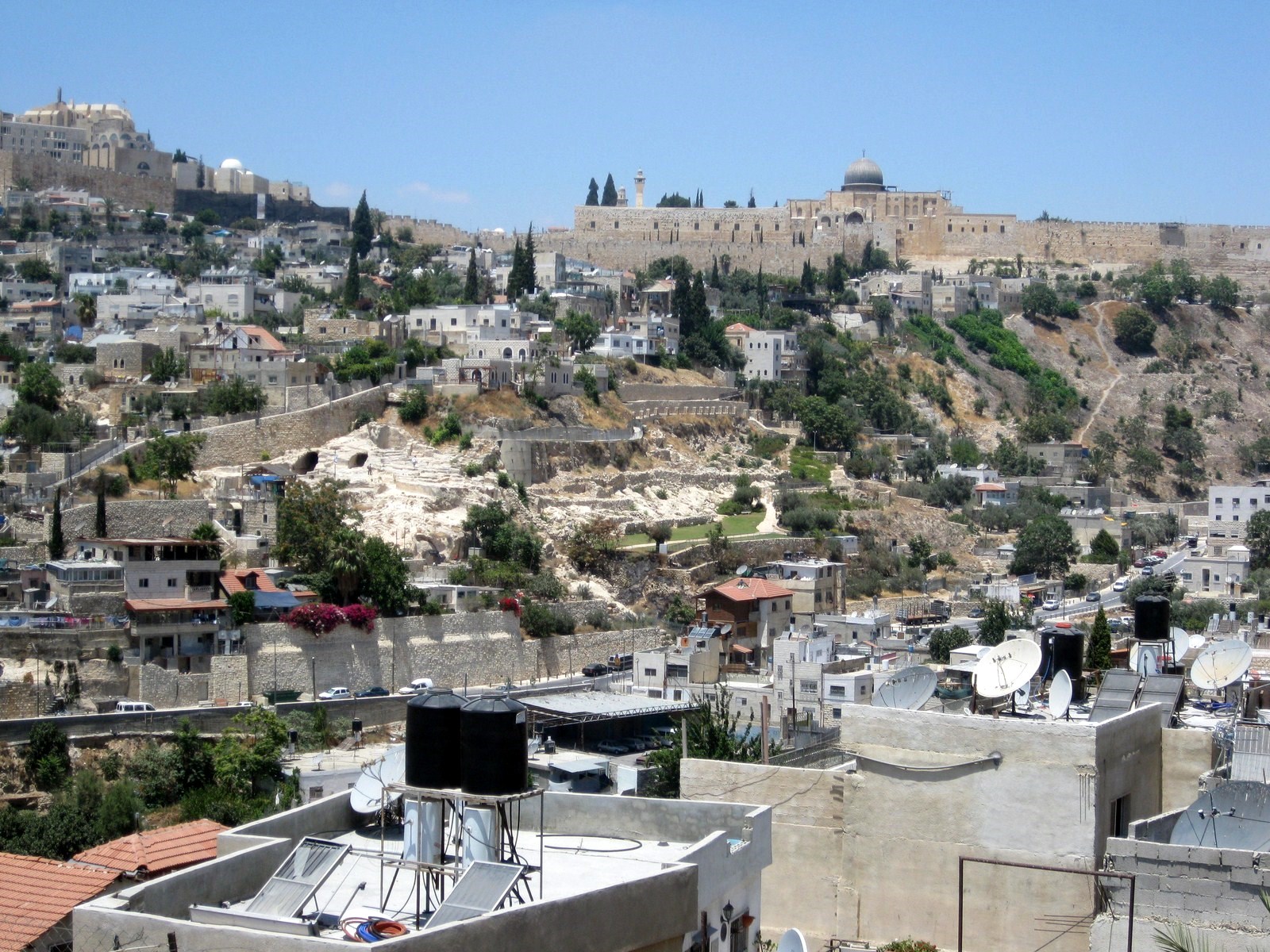
May 2018 - Silwan with "Emek Shaveh"
Our tour was led by Yoni Mizrahi from Emek Shaveh , which is “an Israeli NGO working to defend cultural heritage rights and to protect ancient sites as public assets that belong to members of all communities, faiths and peoples.” (Emek Shaveh website, 2018).
Silwan is a Palestinian neighborhood just south of the Old City. It’s also the site of the City of David, an Israeli settlement and archaeological site which is thought to be the ancient original urban core of Jerusalem. This tour focused on the role of archaeology in the Israeli-Palestinian conflict and its effect on planning in the area.
 Wadi Kidron (credit Tirtza Finkel)
The site was first explored by British and German archaeologists in the late 19th century, who were the first to assert that the area could be the site of the biblical City of David. The Gihon spring below is thought to have been one of the reasons the original Jerusalem was located where it was, in addition to the proximity of nearby Mount Moriah, today the site of the Dome of the Rock/Haram Al Sharif. Archeologists in the 1920’s found evidence that dated the area to the Bronze age. Israel began excavating the site in the 1970s following East Jerusalem’s capture in 1967, and identified the site as the original Jerusalem, specifically the site of King David’s palace, a claim which is contested by some scholars today. In 1997 the site became managed by the Ir David Foundation, but is considered a national park. Since the management change, the park has expanded and become a top tourist destination.
 City of David (credit Emek Shaveh)
In recent years Jewish Israeli settlers have began moving to the area with the help of government support. The government provides improved infrastructure, security systems and guards, and is even building a brand new park in the bottom of the valley. Settler homes are connected by an attractive alleyway leading from the City of David compound down to the valley floor to the exit point of Hezekiah’s tunnels. Visitors can easily visit the City of David, explore the tunnels, and return without setting foot in Palestinian Silwan.
Across the street from the City of David, excavations are underway at the Givati parking lot, and more are planned in other areas close to the Old City. These digs effectively create a barrier between Al Aqsa mosque and the surrounding Palestinian neighborhoods, making it more difficult and time consuming to get there.
 Givati parking lot excavation (credit Tirza Finkel)
Besides offering a clear, side by side example of neglect by the municipality, the City of David/Silwan example shows how history and archeology are used as a political tool to manage planning outcomes in East Jerusalem. The claim that the area was the site of King David’s palace works to strengthen Jewish ownership over Jerusalem, garner support for increased settlement in East Jerusalem, and justify government support of a Jewish presence, often at the expense of the Palestinian Jerusalemites living next door. Though investigating Jerusalem's past is undoubtably important, the antiquities law that allows the government to declare an ancient site is too easily able to be used as a tool to “demographically” manage the city, especially in East Jerusalem.
 End of the tour picnic and discussion (credit Miriam Fisher)
We ended our tour in a rare quiet, green space inside the Old City. Over our customary picnic of fruits, crackers, and hummus, we discussed insights from the tour. Most participants commented on the fact that they would have liked to go deeper into Palestinian Silwan, to see how the neighborhood functions. This point illustrates exactly the divisive side effects of archeology in Jerusalem, intended or not.
Upcoming tours: 2018
January 2018 - Har Homa with “Tzahor”
Har Homa is a Jerusalem neighborhood south east of the city that is actually closer in proximity to Bethlehem. This tour will be led by representatives from the local community association, in addition to Yossi Havilio of the NGO Tzahor, which provides free legal advice and assistance. Tzahor helped Har Homa residents oppose the installation of a waste dump facility on the edge of their neighborhood. Besides this and other environmental concerns, we will focus on the geopolitical context the neighborhood exists in, and other challenges in creating a thriving neighborhood so far from the city itself.
The topography of the area and desire for density has lended to this lego-like construction that characterizes the neighborhood. Credit: Michael Jacobson
Har Homa is located over the “green line” and is not physically connected to the rest of Jerusalem.
The topography of the area and desire for density has lead to this lego-like construction that characterizes the neighborhood. Credit: Michael Jacobson

March 2018 - Lifta with “Save Lifta”
Lifta was a Palestinian village located on what is today a small valley near the entrance of Jerusalem. “Save Lifta” is an organization at the center of a struggle between people who want to preserve the historic village, and a plan for the creation of a new luxury neighborhood amongst the existing village homes.
Depopulated homes on a hillside in Lifta. Credit: Yehudit Alyaoff
April 2018 - Silwan/City of David with “Emek Shaveh”
Silwan is a Palestinian neighborhood just south of the Old City. It’s also the site of the City of David, an Israeli settlement and archaeological site which is supposed to be the ancient original urban core of Jerusalem. This tour will describe the role of archaeology in the Israeli-Palestinian conflict and in the life fabric of the village.
A view of the Old City from Silwan. (credit: Emek Shaveh)
May 2018 - Ein Rafa
Ein Rafa is an Arab village just outside Jerusalem, across Highway 1 from Abu Ghosh. This tour will be lead by local community leaders and focus on how a new detailed plan for the region will affect the tiny village.
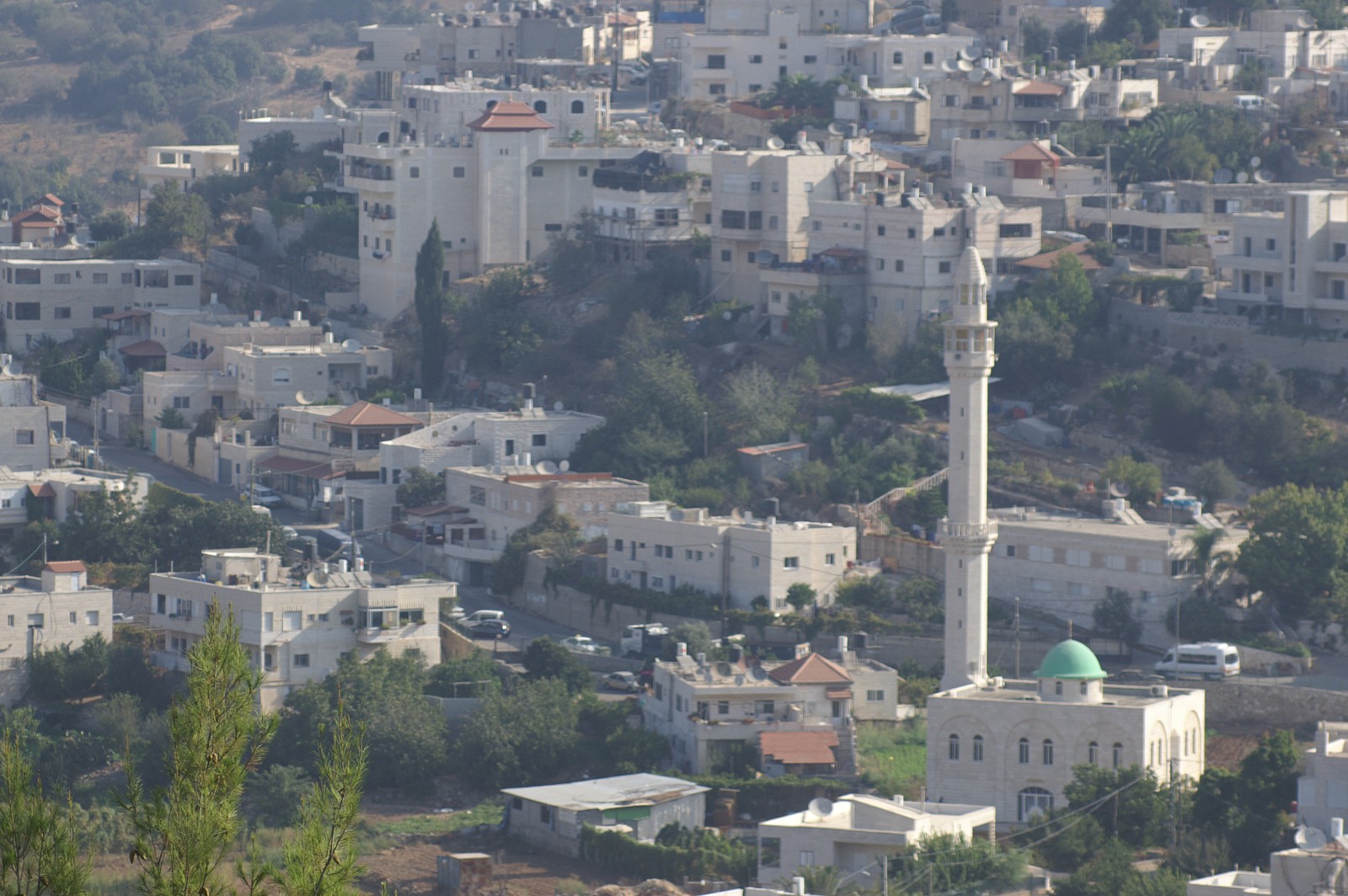
View of village of Ein Rafa. Credit Oren Peles.
Previous Tours: 2015-2017
2017: Ginot Ha'ir | Talpiot Mizrach
19.05.17 | Shmuel HaNavi - Planning and Managing Shared Spaces in an Ultra-Orthodox Community
In a tour conducted in partnership with Eshkolot Community Center, participants examined the delicate balance between cultural sensitivity and municipal creativity. Shmuel HaNavi is an ultra-orthodox neighborhood with unique, and deceptively diverse opinions regarding ownership, public spaces, and what constitutes appropriate public conduct. Tour participants discussed the role of planners as they attempt to satisfy municipal goals within unique, cultural contexts.
Link to Background Information Handout (Hebrew)
21.04.17 | Nachalat Shiva - Private and Public Interests in the Heart of Downtown
This tour was led by the Lev Ha’ir Community Center as well as local urban planners and community organizers. City Centers not only belong to the people living upstairs, but to all of the city’s residents. They serve as a sort of “living room” for the city, in that they provide a place to meet, eat, and enjoy public spaces and institutions. In a capital city such as Jerusalem, ownership is split even more ways, as the center of the city is seen not only as the heart of the city, but also in many ways, the country. In our tour of Nachalat Shiva, we explored the tensions between public-social and private-economic interests, and questioned the proper balance between accommodating foreign and Israeli tourists, and satisfying neighborhood residents.
4.3.17 | Ginot Ha'ir (City Gardens) - Development of public space in a well established neighborhood
About 20 planning students, members of the clinic, and Jerusalem residents toured the Ginot Ha’Ir area as part of a discussion on urban renewal and public participation in planning. The tour was coordinated by representatives of the Ginot Ha’Ir Community Center, which serves nine historic Jerusalem neighborhoods including: Mishkenot Sha’ananim, Rehavia, Kiryat Shmuel, Talbieh, Old Katamon, the German Colony, and the Greek Colony. These neighborhoods are characterized by stylish, historic homes and affluent residents. In neighborhoods such as these, public participation in the planning process is generally high. While public participation is always the ideal, it can also produce obstacles such as NIMBYism and resistance to change. During the tour we learned about the development of public spaces within an already well-established neighborhood.
Link to Full Description (Hebrew)
30.03.17 | Beit Hanina - An Example of the Unique Developmental Challenges Faced by East Jerusalem Neighborhoods
Beit Hanina is a Palestinian Neighborhood in East Jerusalem. For most of the Jewish Israelis on the tour, this was their first time visiting. During this fascinating tour, we saw the differences in development of the neighborhood before and after 1967, and delved into the unfamiliar territory of statutory planning, and its effects on communities that were largely informally built. We were impressed by the exceptional community work being carried out by the local administration, especially in the face of political, and physical barriers. We examined one of these barriers, the separation wall, and the challenges it imposes on planning initiatives and the daily life of the neighborhood’s residents.
Link to Background Information Handout (Hebrew)
10.03.17 | Talpiot - An industrial neighborhood on the verge of urban renewal
Talpiot is a southern Jerusalem neighborhood characterized by its expansive industrial zone, block style apartments, and immigrant roots. Today, the area is on the verge of major plans to increase density, raze-and-rebuild outdated apartment buildings, and rejuvenate industrial spaces for communal use. Our tour, which included around 20 students, professionals, and residents, was guided by Talpiot community urbanner Adi Peri, along with community social worker Liron Gantz. Together we explored the possible ramifications of these dramatic, and rapid changes, as well as the what affect they might have on the future physical, demographic and social fabric of the neighborhood.
Link to Background Information Handout (Hebrew)
Link to Full Description (Hebrew)
Friday Tours (2016): Bukharim | Talpiot Mizrach
4.3.16 | Talpiot Mizrach
Our tour to the neighborhood that the Brits once defined as "forbidden for residential development" dealt with the various challenges posed by topography and political unrest in the area. Can the new revitalization plan, initiated by the ministry of housing, help improve issues of mobility and neglected public spaces?

22.1.16 | Bukharim
Our first tour of the year focused on the Ultra-Orthodox city center: the Bukharim neighborhood. The community urban planner and the municipal planner of the borough discussed their working relations with the different communities, the balance between the functions of a city center and the demands of a separatist population, and the potential of participatory planning for advancing a more child friendly public space.

Friday Tours (2015):
Romema | katamonim | City center | Kiryat yovel | At-tur | Gilo
26.12 | Romema
Our first Friday tour took place in Romema neighborhood. The event dealt with the conflict between the need to develop lands designated for public use and the need to respond to the demands for housing in the Ultra-orthodox local community. This was showcased by the current master plan for the re-designation of a local industrial area.
Click for the summary book (Hebrew) >>
23.1 | Katamonim
The tour to Katamonim neighborhood dealt with the social impact of a large scale raze and rebuild plan that is expected to radically alter the nature of the current community and built environment. The tour offered the local leadership's perspective on issues such as social and economic gaps in the area, public participation, planning of green areas and more.
Click for the summary book (Hebrew) >>
27.2 | City Center
The tour to the city center focused on conflicts and tensions in the process of economic development as showcased by a failed private commercial center that is being gradually transformed by various civil society organizations. It also offered insights into the special place of residents in the city center, and the local leadership dilemma between the municipal urban policy of sustainable planning for pedestrian and culture spots and the residents' needs for motor accessibility and social services.
Click for the summary book (Hebrew) >>
20.3 | Kiryat HaYovel
The tour focused on long term public participation agenda through a local planning process of a city park in the neighborhood. The project included creative methods for public learning and conflict resolution, dealing with conflicting narratives of local history and issues of memorialization and more. The guides also offered their insights following their experience with organizing local resistance to a raze and rebuild project in the adjacent street.
Click for the summary book (Hebrew) >>
8.5 | A-tur
The tour dealt with the challenges of planning in an atmosphere of constant conflict. What are the implications of plans ignoring existing housing? Can alternative planning induce change? How do we plan public buildings where almost all the lands are privately owned?
Click for the summary book (Hebrew) >>
19.6 | Gilo
The tour focused on a raze and rebuild project that includes a large share of public housing, an uncommon occurrence in the Israeli context. A guided tour with the community planner, the borough planner, a leader of the local "Urban Kibbutz" and the social worker explained how they view the history leading to the closing of what used to be an immigration center, the way the different communities share the space and what would or should be the regeneration plan for this unique location.